Wednesday, June 30, 2010

Fairbanks


Today is Tuesday, June 29 and our 20th day of travel. We drove from Tok to Fairbanks on Highway 2 in a gentle rain.. The highway today was excellent and took us in a NNW direction. We left Tok at about 7 a.m. and got to Fairbanks at about 2 p.m. Today we saw several moose, one with a baby. We did stop at North Pole, Alaska and have a little chat with Santa. After that we had our first look at the Alaska Pipeline as it crossed a river. We went to Pioneer Village for a Salmon Bake this evening. We had prime rib, salmon, halibut, and cod with all the trimmings and dessert. We then walked around the village and saw many different antiques.


Monday, June 28, 2010


Saturday we drove from Whitehorse to Dawson City in Yukon Territories. It was a rather uneventful 349 miles. We did find a place called Moose Creek Lodge that was supposed to have good food and pastries. It did not look very promising, but the food was great! I had a grilled roast beef, onion, and cheese sandwich on homemade bread. Then had a raspberry tart that was delicious.

We went to the “dome” when we got to Dawson City. It is a high point that overlooks the city and the Yukon and Klondike rivers. From above the city, the places where they dredged the Klondike river for gold look like big worms. From the highway, the dredging looks like big mounds of rocks. The area between the street and river is a green belt that had lots of activity--people camping, kids playing, and walkers. The guys went to fill with fuel and to get a few groceries. Milk was $8 a gallon, so they decided we really didn’t need it for another day or two.

Sunday we didn’t go very many miles, but we were on The Top of the World Highway. To go from Dawson City to Chicken in Alaska, first you have to cross the river on a barge. We left the campground at 6:45 and had a 90 minute wait for our turn to cross the river. Then it was 80+ miles of gravel roads up and down the tops of mountains with a little rain thrown in. The views were truly amazing. In the middle of nowhere, was the port of entry back into the United States. We stopped for lunch in Chicken. We drove on to Tok. The first thing we did when we got to Tok was to wash the rigs.
Monday is a day of rest for us. It has rained all night and is still raining. We are just doing the maintenance things like washing clothes, getting groceries and watching a little TV.

Friday, June 25, 2010

Train Trip


Today, June 25, we got on a bus to take us on a train trip! How about that!!! From Whitehorse, YT we took Highway 2 or the South Klondike highway and stopped at Carcross, YT. Carcross stands for caribou crossing or the narrows the caribou used go between two lakes in the area. There is an area of sand dunes know as the Carcross Desert close by. The sand came from lake-bottom material left behind by a large glacial lake. It looks like the OK sand dunes except it has pine trees growing in it.


Then it was on to Fraser, BC where we boarded a narrow gauge train, the White Pass and Yukon Route Railroad which was completed in 1900. We saw spectacular scenery as we rode to Skagway, Alaska. There were two tunnels, several bridges, lots of waterfalls, high mountains, and sheer drop-offs. It was a fun trip.


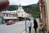
Before getting off the train, our passports were checked because we were now in the U.S. We had also crossed a time zone. Skagway was one of the staging areas for the gold rush in the Klondike. Now it is a port for cruise ships and so there are lots of tourist shops--especially jewelry shops. It is a neat little town--with a feel similar to Leadville in Colorado except the shopping is more upscale. I found a quilt shop with great Alaskan patterns and purchased a little fabric.


Back on the bus and heading back to Whitehorse and another passport check to get back into Canada. We got back about 6.

Thursday, June 24, 2010

Observations

North of Watson Lakes for many miles, rock messages are spelled out along the highway on the slopes of the ditches. The rock messages were started in 1990 by a Fort Nelson swim team. Now there are lots of names and messages.

The continental divide divides two of the largest drainage systems in North America--the Yukon River and the Mackenzie River watersheds. The Yukon goes 2300 miles to the Pacific Ocean and the Mackenzie flows north and empties into the Arctic Ocean after 2650 miles.

The landscape is full of small, calm lakes surrounded by pines just like the pictures you have seen. We did follow a lake for a while that was 86 miles long, so there are huge lakes here too.

We have crossed the Rocky Mountains and now are in the Cassian Mountains, which are not quite as rugged as the Rockies.

We are traveling with a couple who were here four years ago and there were not many people traveling then. This year there are lots of campers and trailers. The RV parks are about filled by evening. There are many pull-outs along the highway for truckers and travelers.

It is light here 23 hours of the day this time of year. The sun was still not set at 10 p.m. The first day of winter they have about 5.5 hours of daylight.

British Columbia is the energy capital of Canada with gas wells everywhere. The RV parks had many oil workers living in them.

Today we are riding a train to Skagway.

In Yukon Territories

Happy Birthday to you!
Happy Birthday, dear Haley!
Happy Birthday to yooooouuuuu!
Happy Birthday you 18 year-old.

Monday was quite a day. We were driving along on great roads when all of the sudden we hit a ROUGH spot. I think everything was airborne for a second and then more bumps. The result was a collapsed table and two scrambled recliners. Our noon stop was on top of a mountain pass and it rained and hailed for about 20 minutes. The ground was white. We took off in a light rain and ½ mile down the road it was clear. That evening the guys glued our table back together and it is okay again. The recliners are a little worse for wear.

We stayed at Testa River Campground which is the mosquito capital of BC. The place generated its own power and had been in the family since the road was built. We saw two caribou, a mother bear with two cubs, bighorn sheep, mountain goats, and buffalo on the roadside.

Tuesday night we stayed in Watson Lake, YT. This is the town with the park in the center of town that has signposts with signs from all over the world. It is quite a spectacle. Off to Whitehorse.

Monday, June 21, 2010

The Alaska Highway

We stayed overnight in Beaverlodge because the rv parks we called in Dawson Creek were full. So we had a short hop today to Dawson Creek. Our first little glitch for the day was to put some air into one of the truck duals. It has had low pressure several days. The second little glitch was the friend's slide that would not retract. So it took a while to get things done. But we gained another hour and were in Dawson Creek by 8:30. Then we settled into the campground, walked Charlie, and started some washing. We toured the museum, art gallery, saw a film about the making of the Alaska Highway in the early 40's, took pictures of everyone at Mile Zero, went a few miles and looked at one of the original bridges, stopped for some supplies, got the truck tire fixed, and then went out for supper. It was another busy, vacation day!

Sunday, June 20, 2010

In Canada


Friday night we stayed at Tunnel Mountain campground in the Banff National Park in Canada. Yesterday we headed to Lake Louise which is a mountain resort located on a lake. Everything there was incredibly beautiful. Then it was up 93 highway through the mountains. The Rocky Mountains in Canada are HUGE. We saw lots of snow and many glaciers. The rivers are a blue hue from the small mineral flakes in the water ground from the rocks as the glaciers move. We also saw mountain goats and bighorn sheep in our travels. This was our first sunny day since we have left home. The first picture is of the icefields. If you can increase the size of the picture, you can see buses that take people to the middle of the icefield.The second picture is of the wildlife crossovers that are built above the highway near Banff.

Thursday, June 17, 2010

Glacier National Park

Thursday we visited Glacier National Park in northwestern Montana. Glacier Park has many glaciers, mountains, waterfalls, and mountain goats. We saw mountain goats as they were in a cliff area where they lick certain boulders for their minerals. We drove half of the Going-To-The-Sun Road because the pass through the mountains was still closed. It was a rainy day so there was new snow on the high mountains. This is one of my favorite national parks.

Wednesday, June 16, 2010

LIttle Bighorn


The battle between Custer's soldiers and the Indians covered several miles. On the rolling hills above the Little Bighorn river are white markers where soldiers died and brown markers where Indians died. Custer divided his troops with Majors Benteen and Reno. Custer and his 225 troopers were all killed because he did not realize that the Indian village he was attacking have 2000-3000 Indians.
This national monument is very well done and an interesting place to visit.

Monday, June 14, 2010

In Montana

The wifi connections have been poor or worse. We were in Gillette, Wyoming for two days. We spent Sunday checking out the Devil's Tower. It is 825 feet high and is the core of a volcano. It was designated the first national monument by Teddy Roosevelt in 1906. This morning we toured a coal mine. The Powder River valley sits on a 100 foot layer of coal that is mined from a large pits. There are 15 coal mines in the valley. It was very interesting and the Eagle Butte mine we visited sends coal to St. Mary's. Tomorrow we are visiting the Custer Battleground. Sorry there are no pictures but I hope to have some soon.

Thursday, June 10, 2010

On the Road

For those of you who are expecting something about sewing or quilting, you are going to be disappointed. We are headed to Alaska with our fifth wheel and so for the near future my blog will be about our travel adventures. I had a doctor's appointment this morning so we could not leave until 12:00. But at 12 we left Carbondale with two other couples. We thought we were going to head north to 36 highway but we ended up heading west. We are stopped this evening at Hays because the Mercer's have a daughter, granddaughter, and great granddaughter who live here. All nine of us ate Mexican and now are just relaxing. We had a great visit and a good drive today. Tomorrow I may have pictures.

Friday, June 4, 2010

Cupcake Decorations

These are cupcake decorations that I made with my embroidery machine. The design was made from a star shape with a circle in the middle. I used temtex as the stabilizer and fused fabric to it. My trusty Bernina sewed the satin stitch around the inside and outside. Frost your cupcake and then one of these decorations will fit about half-way up around the cupcake paper. These will be used for our July celebration. There is a website that has many paper "cupcake collars" that can be purchased. They are printed on paper and then laminated.

Tuesday, June 1, 2010

The Stitchout


The is the stitchout on the back of my jacket. I have a lavender top that I will wear with it, so the purples are just right. I like it.